With a land area of 1,481.12 square kilometers (571.86 sq mi), the municipality comprises 14.83% of the total area of Agusan del Sur, which is 9,989.52 square kilometers (3,856.98 sq mi). This makes La Paz the largest municipality in the Philippines in terms of land area.
According to the 2020 Census, its population was 30,969, making up 4.19% of the province’s total population or 1.10% of the Caraga region’s overall population. With these statistics, the population density can be calculated at 21 individuals per square kilometer or 54 individuals per square mile.
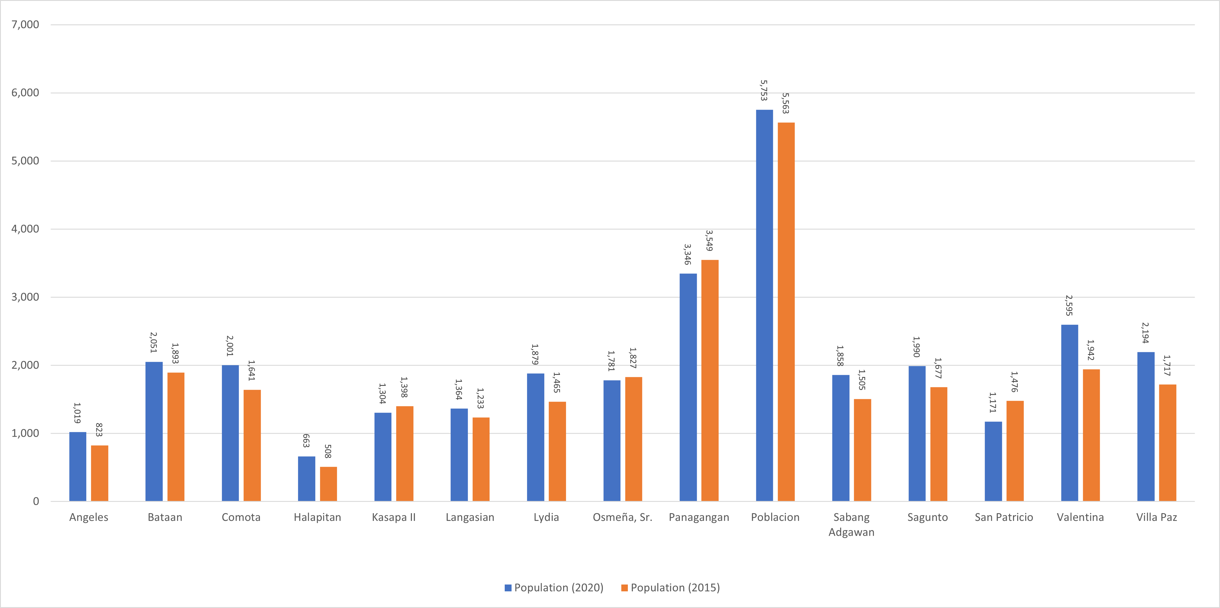
Esperanza has 15 barangays. The graph and table below show the population per barangay for the years 2015 and 2020.
Barangay
Population (2020)
Population (2015)
Angeles
1,019
823
Bataan
2,051
1,893
Comota
2,001
1,641
Halapitan
663
508
Kasapa II
1,304
1,398
Langasian
1,364
1,233
Lydia
1,879
1,465
Osmeña, Sr.
1,781
1,827
Panagangan
3,346
3,549
Poblacion
5,753
5,563
Sabang Adgawan
1,858
1,505
Sagunto
1,990
1,677
San Patricio
1,171
1,476
Valentina
2,595
1,942
Villa Paz
2,194
1,717
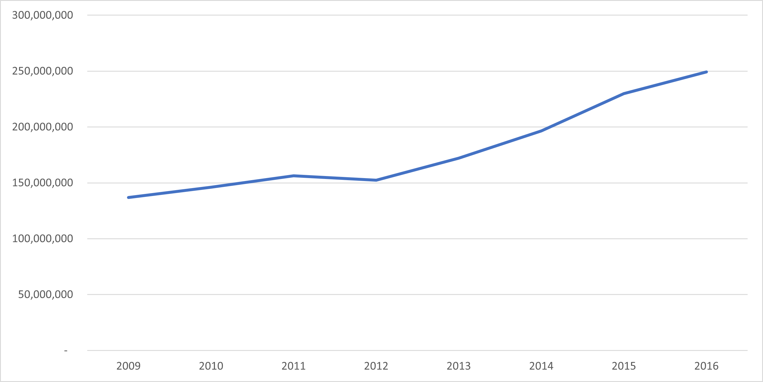
Economy
Fiscal Year
Annual Regular Income
2009
136,901,705
2010
146,111,694
2011
156,447,540
2012
152,451,036
2013
171,984,270
2014
196,504,743
2015
229,849,347
2016
249,315,959
End notes:
Annual Regular Income = Locally Sourced Revenue + Internal Revenue Allotment (IRA) Current Year + Other Shares from National Tax Collection
Locally Sourced Revenue = Real Property Tax (General Fund) + Tax on Business + Other Taxes + Regulatory Fees + Service/User Charges + Receipts from Economic Enterprises
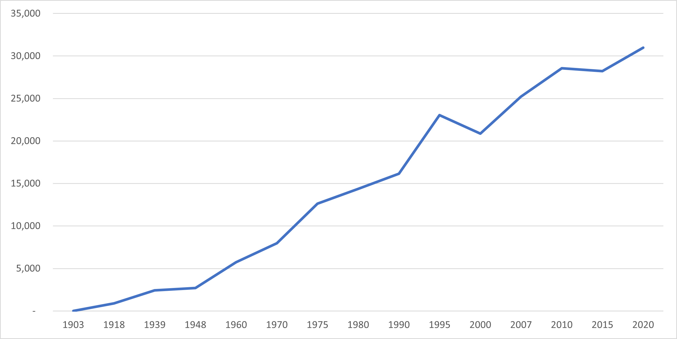
Population
Census date
Population
1903
–
1918
908
1939
2,418
1948
2,701
1960
5,746
1970
7,971
1975
12,634
1980
14,389
1990
16,144
1995
23,044
2000
20,880
2007
25,214
2010
28,562
2015
28,217
2020
30,969
La Paz’s population has experienced significant growth over the last century, increasing from 908 residents in 1918 to 30,969 individuals in 2020. This represents a total population growth of 30,061 people over a period of 102 years. According to the latest census figures in 2020, La Paz’s population continues to grow at a positive rate of 1.98%, with an increase of 2,752 people from the previous population of 28,217 in 2015.